2015 EFS Company News Update
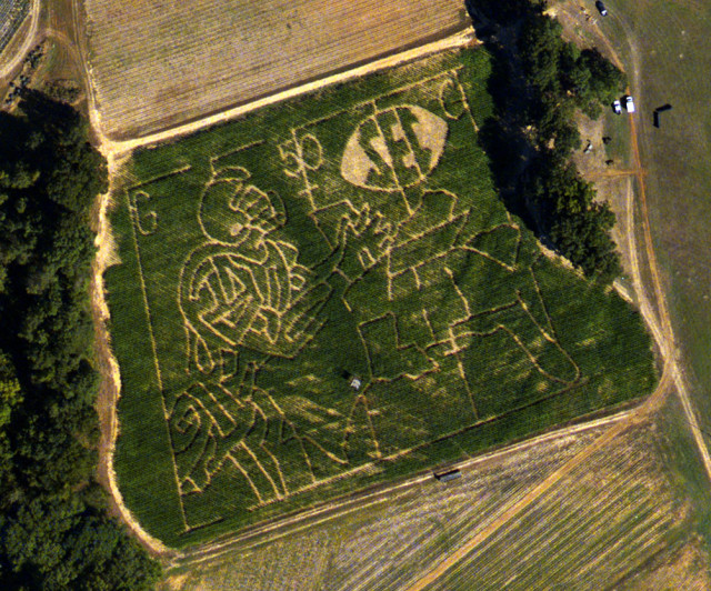
Aerial Photography

The EFS Image Processing Team has completed all Winter Mapping Projects from the 2014-2015 season and are currently working on summer/fall forestry site prep imagery as well as getting prepared for the 2015-2016 Winter Mapping Season which will begin around the middle of December.

secnation2
Field art of a corn maze captured during a recent aerial photography collection.

EDGE

The EDGE team has been busy presenting EDGE in 2015 and are excited for the opportunity to work with several new counties and cities in the coming months.

ONE COUNTY MAP

EDGE is designed to be used as “The Map” for the County.  It is more than an Assessor’s Tool for Parcel Mapping or Judge’s system for County Road Management.  EDGE places all data being mapped in the County in one central location.  For the counties currently using EDGE it has become the source for the most up to date map of the County.
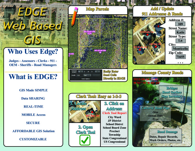
County_Inside_Print

EDGE For Cities

EDGE is being used by multiple cities as well.  Cities in Arkansas and Mississippi are using EDGE to keep track of the utility systems such as water and sewer lines and associated features.  New in 2015 is also the customized Nuisance Property tracking module.  The Nuisance Property module can be customized to allow your city to not only keep track of where your nuisance properties are but also what phase they are in for remediation.

City_Inside_Print2


Publicly Available EDGE Sites

Currently the following sites have been opened to the public to view the County’s EDGE Map:

(*To View on Smartphone add /Mobile to end of above link*)

Conferences Attended

EFS has had a busy conference schedule this year.  Below is a list of conferences attended in 2015:

  • January 27-29 – Ouachita SAF Conference
  • February 08-10 Arkansas County Judges Winter Conference
  • June 09-12 Arkansas County Assessors Summer Conference
  • June 21-24 Association of Consulting Foresters Conference
  • June 24-26 Arkansas Municipal League Conference
  • August 04-07 Association of Arkansas Counties Conference
  • September 01-04 Arkansas GIS Users Conference
  • September 30-October 02 – Arkansas County Judges Fall Conference
  • October 26-29 – Arkansas County Assessors Fall Conference

Staff Notes

Bussell Joins EFS Team

Chris Bussell SIS Specialist
September 30, 2015 – Chris Bussell of Monticello, AR accepted a position with EFS to join the Image Processing Team. Bussell graduated with a B.S. in Spatial Information Systems (Surveying Option) from the University of Arkansas at Monticello in 2010. Before attending UAM in 2006 Chris served in the United State Army from 2001-2006 as a Network Systems Operator/Maintainer and was deployed to Iraq in January 2005.

Hartshorn Named Vice President of EFS

July 27, 2015 - The EFS Board of Directors named James Hartshorn, Director of Product Development, as Vice President of Eagle Forestry Services, Inc. / EFS GeoTechnologies. James will continue in his role as lead developer of EDGE while taking on more responsibilities in the day to day management of EFS.
July 27, 2015 – The EFS Board of Directors named James Hartshorn, Director of Product Development, as Vice President of Eagle Forestry Services, Inc. / EFS GeoTechnologies. James will continue in his role as lead developer of EDGE while taking on more responsibilities in the day to day management of EFS.

Dabney Appointed to Monticello Municipal Airport Commission

January 22, 2015 - The Monticello City Council approved the appointment of EFS President, Glen Dabney, to serve on the City's Airport Commission. Pictured above Monticello’s Mayor Zack Tucker (left) presents Glen Dabney (right) with the appointment resolution from the City Council.
January 22, 2015 – The Monticello City Council approved the appointment of EFS President, Glen Dabney, to serve on the City’s Airport Commission. Pictured above Monticello’s Mayor Zack Tucker (left) presents Glen Dabney (right) with the appointment resolution from the City Council.


EFS GeoTechnologies is an Aerial Photography and GIS Services company based in Monticello, Arkansas. To learn more about EFS please visit www.EFSGEOTECH.com. Also, to receive updates from EFS you can follow them on Facebook and Twitter.

Similar Posts

  • GITA Conference 2012

      Come by Booth #212 at the GITA Oil & Gas Pipeline Conference for Your Chance to Win a New Google Nexus 7! Join us on October 22-24 in Houston, TX Stop by EFS GeoTechnologies’ Booth (#212) and visit with Glen Dabney (President) and James Hartshorn (Director, Product Development) at the GITA Oil & Gas…

  • Dabney Reappointed to AR State GIS Board

    The Arkansas Geographic Information Office (AGIO) announced Wednesday Glen E. Dabney, R.F., A.C.F. President of EFS GeoTechnologies, was appointed to a second term on the Arkansas GIS Board by Governor Mike Beebe.  The Arkansas GIS board, comprised of twelve members from state and local government, the private sector, and institutions of higher education, works with the AGIO to coordinate…

  • Justin Rollans Joins EFS Team

    July, 2018 – Justin Rollans accepted a position with EFS as Support Analyst for EFS’s EDGE Team.  Justin works with the EDGE Team on development, implementation, and customer support for various GIS projects. Justin is also a licensed commercial sUAS pilot. Born in East End, AR, Justin received his B.S. in Geographic Information Sciences from…

  • EFS Staff Update

    TJ Andrews Joins EFS Team September 4, 2017 – TJ Andrews accepted a position with EFS as Pilot for EFS’s Aerial Photography Team.  In addition to his aerial photography collection responsibilities, TJ has been assisting with EDGE GIS projects when not in the air.  Born in Chicago, IL, TJ received a B.S. in Aviation Flight…